Route & information
5 km Trail Race of Santorini Experience
Location: Oia - Desalination Plant
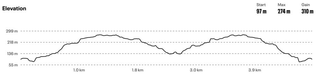
The 5 km route starts with a slight downhill for approximately 250 meters on a wide dirt road, then follows a steep uphill path of 1,250 meters with an average gradient of 12%. The path then narrows and the terrain changes with many stones, requiring increased attention. The gradient is downhill until the turning point, which is at the middle of the route (2.5 km) where there will also be a feeding station.
On the return, we encounter the maximum gradient just before the 3.5 km mark, which approaches 40% (!) for 100 meters. The last 1.5 km of the route are downhill.
Technical characteristics of the route:
Starting-finishing altitude: 146 m.
Turning point altitude: 173 m.
Maximum altitude: 293 m.
Minimum altitude: 135 m.
Total positive elevation gain: 313 m.
Maximum gradient: 37.6%
Route terrain: dirt path with embedded stones in some places